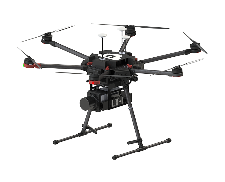
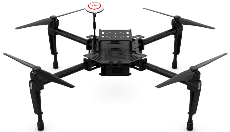
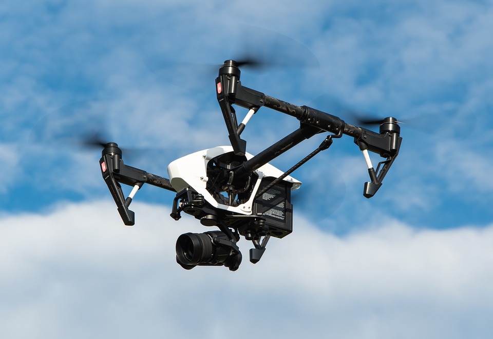
The LX-1 “Echelon” is a professional-grade hexacopter equipped with LiDAR sensing payload designed for a wide range of high-resolution 3D mapping and surveying applications. With a total take-off weight of 12kg, the LX-1 can produce stitched 3D maps with 2-3cm accuracy—allowing surveyors to measure topography on a wide scale, and power line operators to inspect their lines and surrounding vegetation. The software system is plug-and-play, so that the pilot can record and process data without the need for advanced remote sensing or GIS expertise. The complete package flies for up to 20 minutes, built with survey-grade dependability and all-round user friendliness in mind.
Features
- Power Lines & Linear Corridors
- Forestry & Environmental Management
- Transportation & Construction
- Topographic Surveying & Mapping
- Volumetrics and Aggregates
- Accurate Data. LiDAR resolution <3cm with telemetry, RTK, and Kalman filtering for stitching.
- Simple Software. User interfaces for operating the LiDAR payload and the 3D stitching.
- First Person Views. The LX-1 comes integrated with a front-facing camera that live streams to the pilot’s hand controller, making it easier for experts and non-experts to fly.
- 3D-Printable Spares. The LX-1 is based on DJI’s M600 hexacopter platform with all mechanical modifications fully 3D-printable! Should you ever require spare parts, you can print them yourself or we can print and send them to you.
- Rugged transport case. The LX-1 package is delivered in a rugged transport case that can easily fit into pickup truck bays or be shipped as oversized baggage.
Specifications
Dimentions & Weight
- Diagonal Wheelbase - 1133 mm
- Aircraft Dimensions (Propellers, frame arms and GPS/RTK mounts unfolded) - 1688 mm x 1518 mm x 859 mm
- Aircraft Dimensions (Frame arms and GPS/RTK mounts folded) - 640 mm x 582 mm x 673 mm
- Weight (with six TB47S batteries + LiDAR attachments) - 12.1 kg
- Max Takeoff Weight - 15.1 kg
Drone
- Motor Models - DJI 6010
- Propeller Model - DJI 2170
- Retractable Landing Gear - Standard
- Operating Temperature - 14° to 104° F (-10° to 40° C)
- Charger Model - A14-100P1A
- Charger Voltage Output - 26.3 V
- Max Angular Velocity - Pitch: 300°/s, Yaw: 150°/s
- Max Pitch Angle - 25*
- Max Speed of Ascent - 5 m/s
- Max Speed of Descent - 3 m/s
- Max Wind Resistance - 8 m/s
- Max Flight Altitude above Sea Level - 2500 m
- Max Speed - 18 m/s (No wind) – flying at 5m/s or slower is recommended for best LiDAR quality
- Hovering Time - 3 kg LiDAR payload attachments: 20 min
- Flight Control System Model - A3 + custom microcontroller for LiDAR payload
Flight Battery
- Model - TB47S
- Capacity - 4500 mAh
- Voltage - 22.2 V
- Type - LiPo 6S
- Energy - 99.9 Wh
- Net Weight - 595 g
- Operating Temperature - 14° to 104° F (-10° to 40° C)
- Storage Temperature (less than 3 months) - -4° to 113° F (-20° to 45° C)
- Storage Temperature (more than 3 months) - 72° to 82° F (22° to 28° C)
- Max Charging Power - 180 W
Remote Controller Specs
- Operating Frequency - 5.725 GHz to 5.825 GHz 2.400 GHz to 2.483 GHz
- Max Transmission Distance (unobstructed, free of interference) - FCC Compliant: 3.1 miles (5 km)
- Mobile Device Holder - Supports smartphones and tablets
- Output Power - 9 W
- Operating Temperature - 14° to 104° F (-10° to 40° C)
- Storage Temperature (less than 3 months) - -4° to 113° F (-20° to 45° C)
- Storage Temperature (more than 3 months) - -4° to 113° F (-20° to 45° C)
- Charge Temperature - 32° to 104° F (0° to 40° C)
- Built-in Battery - 6000 mAh, 2S LiPo
- Max Tablet Width - 170 mm
Source - https://theskyguys.ca/drone-technology/lx-1-echelon/
Tags:
Monitoring Systems-Surveillance
Gas Leak Detection Services
Drone Survey
Drone Land Survey
The Sky Guys
Established in the year 2015, The Sky Guys is one of the leading drone companies of Canada. The firm engages in the sectors of oil and gas, power, utilities, wind, infrastructure, construction and engineering. Through its advanced R&D arm, Defiant Labs, The Sky Guys developed bleeding-edge UAS systems and AI data analytics.
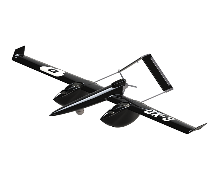
The firm provides inspections, monitoring, surveying and mapping services to some of the major Fortune 500 companies. The Sky Guys’ proprietary softwares includes DX-3 Vanguard, LX-1 Echelon, and GIS Mapping.